|
|
|
|
|
Narrative:
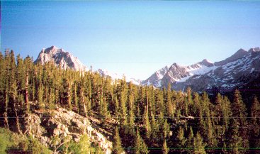
Our hike along the trail was rather uneventful. We chatted and took in the breath taking scenery that is common to the High Sierras. Common though it might be, that fact does not take away from the experience. One view is more breathtaking than the next and there is always a surprise around the next bend or over the next rise.
I had just purchased a GPS device, which I fiddled with as we skirted the large lake which was our companion for the first hour into the wilderness. Of the 7 lakes, 2 where off the trail and would require some bushwhacking to find. I had programmed the coordinates of these lakes into my GPS before we left Oakland, figuring that it would save us from wandering around aimlessly. I'm glad I did because it would turn out that the two lakes were neatly hidden and required a little perseverance to find. If I hadn't had the GPS, I wouldn't have had the confidence to keep climbing in the direction that I was and would probably have turned back. I'm also glad I packed the topo map, though it was of little comfort in finding the hidden lakes. The topo map told me they where there but the GPS told me exactly how far away from them we were.
We arrived at the first lake and where surprised to see several
groups of campers and people walking around with stingers of fish. We
initially found what looked to be a promising spot and after some exploring,
returned to it. This of course was a mistake. On a new lake one should
constantly stay on the move, exploring each area, looking for active fish. On a
chain of lakes one should allocate a time limit for fishing each lake. This
increases the chances of hitting that lake which happens to be on fire that
particular day. We had of course planned this. We agreed at first to spend
an hour or so on each lake, but instead we plopped ourselves down on the first
spot we saw. We had good reason though, it's hard to walk way from an
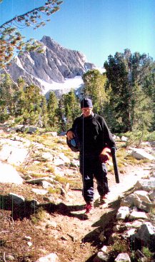
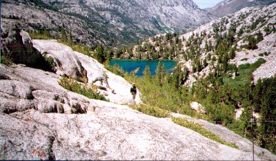
After a while, it became obvious that we really needed to move on. It was late afternoon and we would only have a few hours to explore the other lakes. I pin pointed the other lakes on the map and then the GPS. "We need to go there" I said to Josh and Gino as I pointed to a steep bluff. According to the book, the lakes were a half a mile past the first two lakes and 500 ft higher. The book made it seem like an easy trek and the map didn't help in this regard. The lines which show steepness of terrain were obviously not as close together as they should have been. With a little trial and error, Gino found a path up a rock fall which doubled during run off as a creek/water fall. It was the only route that wouldn't require climbing equipment. Josh stayed behind. My GPS and I took the lead as we climbed the rock fall, crossed the creek and scurried up a steep rise. At one point my GPS read that we where within 400ft of the lake but all we could see were rocks and more rocks. We spread out, each climbing up a different section of stone barrier directly in front of us. I made it to the top and let out a shout. There it was, the lake, nestled neatly in it's own little valley. The problem now was getting down. This lake was the smallest of the 7. It was shallow to boot, just the type of lake I enjoy. One where you can spot cruising fish and easily cast to every position in the lake. At first we couldn't spot fish. Then, just as we were
preparing to blind fish, a gust of wind came up. The water tossed on the surface
of the lake and then was as flat as a mirror. Up -slope blow in? I don't know
but as if on cue, every fish in the lake started to hit the surface. They
stopped, the wind came up again and
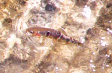
We only visited 3 of the lakes during this trip but had heard from others that fishing at the other lakes on the trail was not good. That only left 1 lake unexplored for the weekend. (Again I have NOT given you the name of these Golden Trout waters. (Don't you hate that.) When it comes to Golden Trout, I think half the fun is in the discovery. I've given enough clues in this narrative that if you're really interested, all you need do is pick up a topo map. I found this water and more Golden Trout waters by doing a little research. It took less then a week and a little research goes a long way.) Sunday, we fished the Owens at Pleasant Valley for an hour. The water was high. Josh fished the deep streamer techniques that where successful for him in Chile, while I fished nymphs below and indicator. We both drew blanks. On the way home, we fished Hot Creek. Hot was crowded as usual but the 3 of us managed to hook into about 30 fish. I fished the Krystal Flash on a hook, Bird Nest combination until I lost them. Josh and I eventually concurred that the fish were taking anything dark in a size 16 or smaller. Successful fisherman were those who seemed to stick and move; they made sure not to spend too much time in one area. I personally found that two split shot, positioned 2 inches or more from each other and 12 inches from the fly allowed me to fish my fly through the aquatic weeds without many hang ups.
Previous John Muir Wilderness Chronicle Next John Muir Wilderness Chronicle
|

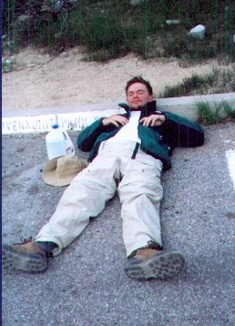 Wasted. That's how we
(an overweight 30 something, an ill Chilean adventurer and an altitude suffering
Georgia transplant) felt after our 3hr hike at close to 11,000. It was worth it
though as all such expeditions in search of trout usually are.