|
|
|
|
|
August 23, 2008 Burgson Lake Time: 12:00pm - 2:00pm Narrative: My quest to fish Burgson Lake began several months ago. I struck up a conversation with a women in the casual commute. The casual commute or casual carpool is how I get to work each morning. There are several casual carpool spots scattered around the Bay Area, usually near a bus stop or train station. Individuals commuting by car pick up folks at these spots and drive into San Francisco together. The passenger gets a free ride to work and the driver is allowed to use the carpool lane and travel across the bridge for free. Sounds a bit scary in this day and age but in 16 years of doing this, I’ve had few problems. Open conversations during the commute are unusual unless you know the individual. Over time, you do tend to see the same people and can become friendly. I met my rodmaking friend Erik in the carpool- he as driver and me passenger. In most cases you don’t know the individuals in the car and it’s sort of an unwritten rule that riders not speak unless spoken to. Most conversations are initialed by the driver. I don’t remember how or why but one day I struck up a conversation with a fellow passenger. I could tell she was a fellow “outdoors person” just by her look. In the Bay Area, there’s a certain look that the hiking crowd have. Her hair, jewelry, the cloths she wore. She had the look. We started talking and she told me about the large trout she caught on her first cast at Burgson Lake. “You should go”, she said.
I was intrigued. A short time later I found myself on google, looking for references to "Burgson Lake", especially any references regarding Burgson Lake and fishing. Unfortunately, searching via google isn’t what it used to be and the search engine picked up a bunch of irrelevant sites. Most of the sites seemed to have lists of every lake and wilderness area in California and invited you to be the “first to review” your chosen destinations. Lucky me. I found zero references to fishing Burgson Lake and only a single relevant reference about a beginning sierra club backpacking trip to Burgson. That was enough for me to find the lake on a map and get some idea of how to get there. What I found wasn’t very encouraging- a small lake, a little more than a mile off trail with seemingly no inlets or outlets. I knew that DFG had stopped aerial stocking this area and the women’s story started to sound more and more like someone who happened upon the lake at the tail end of the last stocking cycle. I had to know for sure so on the Sunday
after Independence Day, my brother in-law Chad and I decided to check it
out. Our conversation that day at the ranger station went something like
this: “Where you headed”, asked the ranger. “Burgson Lake”, I replied. “Burgson doesn’t have any fish” he volunteers, noticing the flies in my hat. “We were told it did and thought we’d check it out. If it doesn’t we’ll just fish elsewhere.” I said.
“No but it’s tough to get to, there is no trail.”
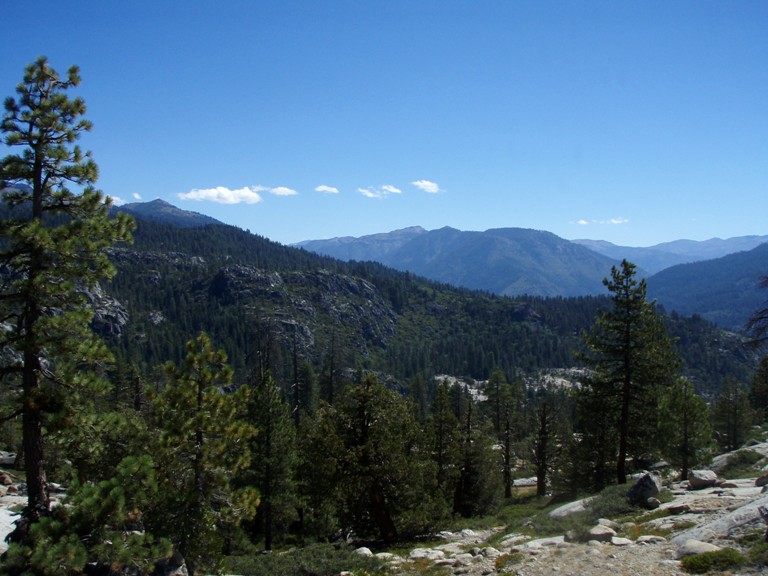
“Thanks!” I said as we left. We crossed the South Fork, Middle Fork and Clark Forks of the Stanislaus on our way to the trailhead and were down the trail in no time. The hike started off with a steep climb through a dense forest into the Carson – Iceberg Wilderness. ”Look for a “snaggle”? The whole forest looks like a snaggle!” I grumbled. We followed the trail until we found the small meadow lakelet. Its circumference was a jumble of fallen logs and twigs but we decided to look for another “snaggle” before making our turn. At the base of a rocky outcropping we left the trail and hiked to the top. From the top we could clearly see a nice lake in the distance. “There it is” we thought. Looking at the map, I suspected that it wasn’t actually the lake but was instead Donnell Reservoir. Donnell is a very large reservoir but from our vantage point we could only see the small cove like portion of the back at it’s north east end. It didn’t feel right and if we’d taken a little more time to look at the landmarks and compare the terrain with the map, we would have known for sure but it was a lake so I figured, what the heck, if it’s the wrong lake, we can still fish. Thus began one of the more dubious adventures I’ve undertaken. There was no obvious route from the top of the outcropping to the lake below so we walked along the top of ridge until we found a “good” spot to go down. Our good spot was a small grove of pines on a an extremely steep slope. Fallen pine needles made it extremely slippery. This was going to be a one way trip- down.
Through the grove we skirted the base of
the rocks, trying to avoid the tangle of manzanita before use. It was
soon pretty obvious that we had no choice but to continue down, through the
chest high manzanita. For the next hour and half we blazed a trail where
there was none. Bushwhacking through the prickly plant, we’d occasionally
come to a small cliff and would have to use a tree to climb down, ala “Man
vs. Wild” only to be met with more manzanita. When we finally reached
“bottom” we realized that we were still several hours from the lake and if
we’d made it to the lake, we wouldn’t have time to fish and would find
ourselves trying to climb out in the dark. We decided to turn around and looked for an easier route up than the one we took down. This meant traversing to the east where there was less manzanita and more rock. You’d think this would be faster but going down is always faster than going up, despite the manzanita. We climbed up granite using long forgotten rock climbing skills to a more forested area. Steep with fallen timbers everywhere, we were constantly zig zagging back and forth to avoid obstacles. We headed for the main trail but found ourselves at a meadow with a well used camp site and from there it was an easy hike to the main road a short distance to the car. Not to be deterred, we fished the Clark Fork on the way home. Last weekend I find myself at the same trailhead, alone, and determined not the make the same mistake. “Trust your instincts and the map, forget what the ranger said”. So I followed our initial plan. I hiked up and over two or three saddles before reaching my turn off point. I had brought along my GPS this time to ensure that I didn’t get lost but I found that the GPS is sometimes misleading. When it can't get a clear view of the sky and update itself, it some times points to a direction that is opposite from your destination. I’m not sure why this is but I’ve got a good enough sense of direction that I recognized it easily and only trusted the GPS when it and my map reading agreed. I flushed several cubbies of what appeared to be Chukar Partridge as I neared my turning point. When I reach the point which I had preprogrammed into the GPS, I wasn’t pleased. It was at the same level as the lake and should have been an easy cross country hike but the terrain was shoulder high ferns and dried up swamp. It felt like something out of H.G. Wells. I took twenty paces and turned around. The stuff was too dense for me to see my feet clearly, let alone find a food point of reference. “I’m not going that way”. I took another look at the map and just ahead there was a small saddle of rock. It meant more climbing but I decide to follow the trail until the undergrowth cleared and then head cross country. And so I did. Mt GPS still wasn’t pointing me in the right direction so I decided to traverse to my right a little and climb to the top of a small rise to get a better lay of the land. I hadn’t been working through the brush for more than five minutes when I came across a trail. I looked at the trail, looked at my map, looked around for the major land markers. There wasn’t supposed to be a trail but here one was and it didn’t seem to fit the main trail. I didn’t have anything to lose so I followed it. I finally reached a clearing and looked at my GPS. It pointed straight down the trail. I knew I was headed the right way.
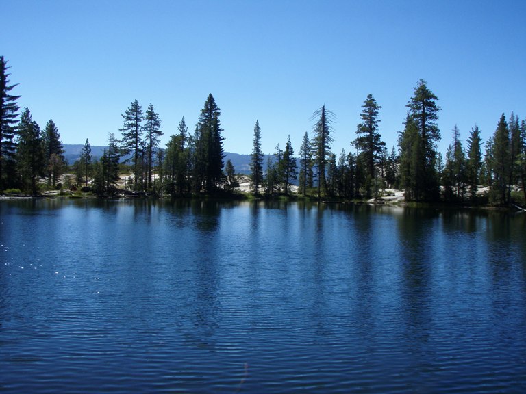
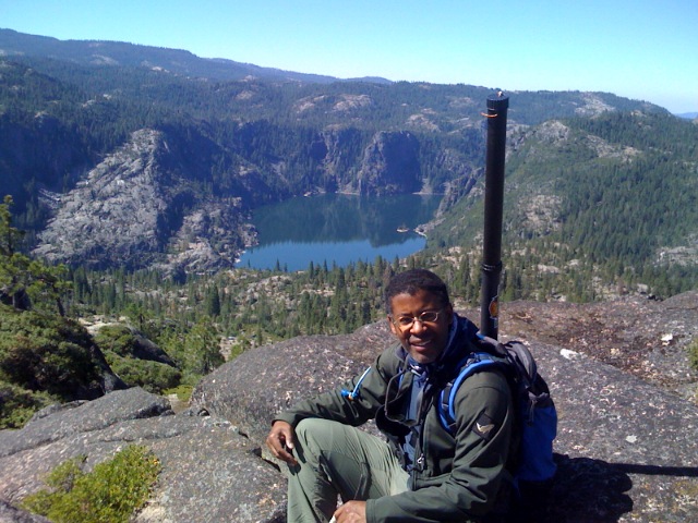
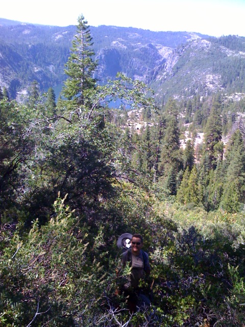
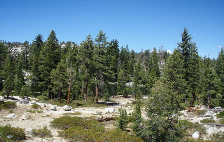
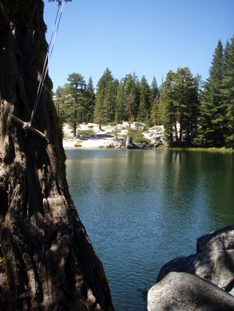
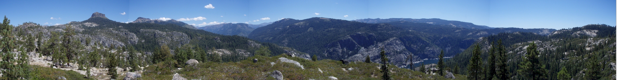
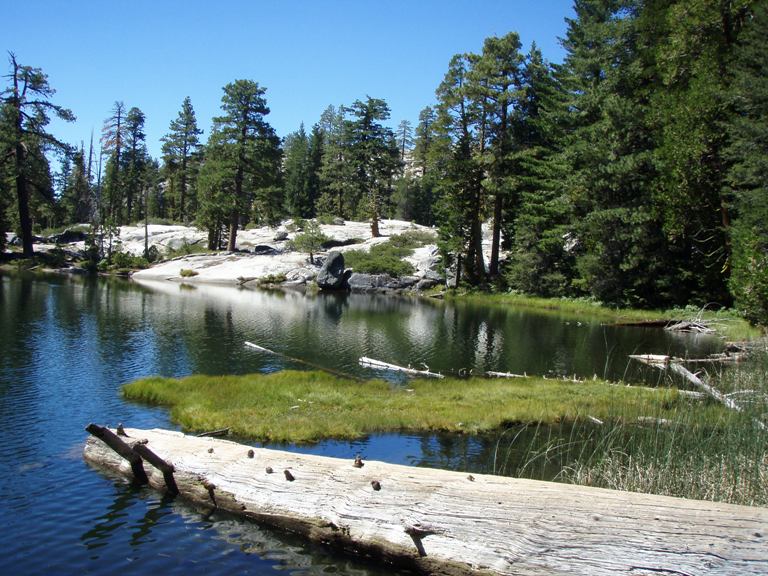
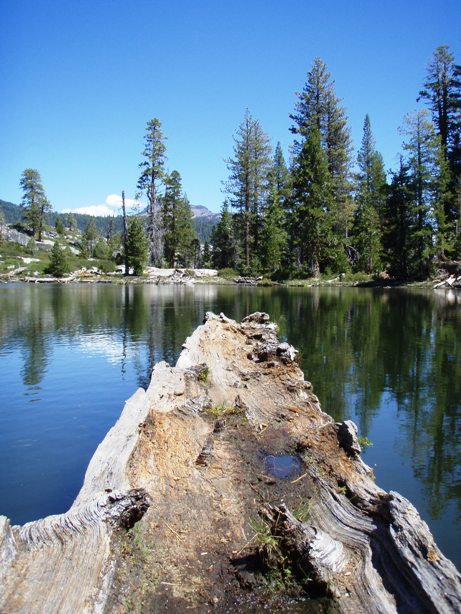
The lake is set in a shallow basin overlooking Donnell Lake. It's almost as if it's sitting on top of the world, Donnell Lake off one shore and the Dardanelles of the other. It was tiny, much smaller than I expected and though it took me over an hour to fish around the lake, I could have walked it in 5 or 10 minutes. The wind was blowing slightly but not so much that I couldn’t see into the water. The water was slightly stained with algae and visibility ranged from 3 to 6 feet or so, perhaps a little deeper in places. I sat and watched the lake for a while- eating and stringing up my rod as I scanned the likely holding spots for fish. There was plenty of fallen and flooded timber, as well as drop off, over which someone had installed a dodgy looking rope swing. I saw no fish.
It reminded me of Camp Lake and so, I fished it in the same manner- first casting a dry close to and over structure and then casting a sinking fly to the same areas. I walked out on a log thinking that I would jump to a little island just off shore (to access deeper water) only to find the island was a floating tarn of sorts. Under it’s grassy surface I could see that most of the bottom portion had worn away. It looked much like a grassy iceberg and anyone attempting to jump to it might find themselves in a lot of trouble. I fished the deep water under the swing as well as a hollowed out log that floated like a canoe. I could walk out on it only so far before my weight started to dislodge it from the shore line. Nearly back at my entry point I found some light colored sand at the base of a boulder which angled into the water. It reminded me of the spawning reds I found at the Hilton Lakes this year and if the lake does hold fish and they were simply deep that day, it’s possible that run off from the bolder might provide enough oxygenation for spawning. That would presuppose of course the fish were rainbow trout or some other spring spawning species. I don’t think fall spawning fish would be able to survive. Despite not finding fish, I had a very pleasant time at Burgson. I spent most of my time searching the water but also spent time finding out what was around the next bend and taking pictures. One would think that the hike back was simple but at about the same point I found the trail on the way in, I lost it as it passed over the low, rocky saddle. There were several “trail markers” but none were accurate. After following one marker for a while I turned around and soon found the correct trail. Then just as suddenly, I found the main trail. I looked at the intersection of the two and realized that I would never had found the lake trail had I not stumbled onto it as I did. I doubt I’ll ever come back to this area now that I’ve satisfied my curiosity but it will remain a vivid memory for some time.
Previous Carson - Iceberg Wilderness Chronicle Next Carson - Iceberg Wilderness Chronicle
|